Using established algorithms and spatial analysis tools we can assess how landscapes, from local to regional scale, are changing through space and time to better understand long term trends or abrupt changes.
Monitoring natural and built landscapes
- Snow cover and surface water
- Vegetation
- Soils and geologic features
- Landscape disturbance
- Built environments

Spatial Analysis
Snow Cover Extent
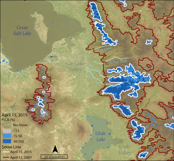
Using remote sensing imagery, land cover models, or measurement sites we are able to carry out spatial and time series analysis. In the above image showing Salt Lake City, UT and the adjacent Wasatch Range fractional snow covered area (fSCA; the fraction of a pixel that contains snow) is shown for the same date in a high and low snow year. Imagery is from MODIS, an instrument on board a NASA satellite, with 1 day temporal resolution and 500 meter spatial resolution. This product is publicly available, and are retrieved through the Snow Data System at NASA JPL. Although this example is for snow, similar analysis could be done for other land cover types, like vegetation, or disturbance analysis, to capture before or after events that change the landscape.
Contact Us
info@contourgroupconsulting.com
